|
|
Enter subhead content here
|
|
Gulf
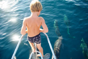
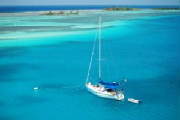
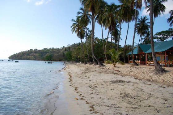
of Mexico Crossing June 2009  | Dolphins on bow | 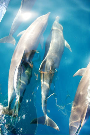

|
| Arrival Galveston,
Texas | 
|
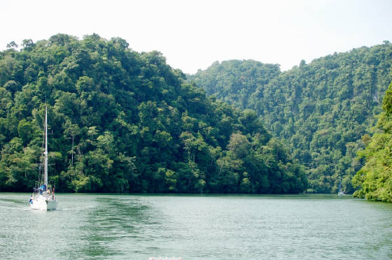
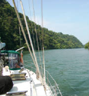
Our Gulf of Mexico crossing was largely uneventful. Weather during June is very settled
over this region. With 655nm to Galveston from Isla Mujeres, we had taken just enough diesel at El Cid
Marina to motor the entire way. We did not want to have extra fuel on Charlotte for trucking.
We ended up motoring/motorsailing for about three and a half of the four and a half days it took for the crossing.
Our biggest challenge was keeping Alden entertained for so many days at sea. We played Scrabble,
Match, Sequence, and lots of other games, read a lot, fished, and listened to books on tape. After hooking
a lot of small Bonito and four larger Barracuda (all released), we finally landed a medium sized Mahi-Mahi. We
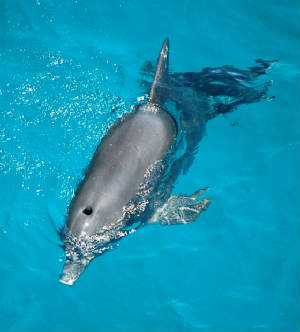
were fortunate to see lots of dolphins. On one dark night, I heard them surface, breath and dive and could
see their bioluminescent wakes. Another day we were accompanied for a half hour by a pod of at least twenty
dolphins. We even saw whales one afternoon with the closest passing about two hundred feet away.
At around noon on the 28th, with about 175nm still to go, we passed our first of many oil rigs; this one
in over four thousand feet of water. The Gulf of Mexico is definitely an oil industry hub for the U.S.
as witnessed by the oil platforms and many supertankers being lightered by smaller (still very large) tankers ready to shuttle
Middle East crude oil to Texas refineries. Finally, at 1400 on the 29th, we sailed through Galveston’s
breakwater and then motored twenty five miles up the Houston Ship Channel. Our biggest challenge of the
trip was clearing our mast below the Kemah/Seabrook bridge at the entrance to Clear Lake. We probably had
a foot to spare!
| Our last Mahi-Mahi-for now..... | 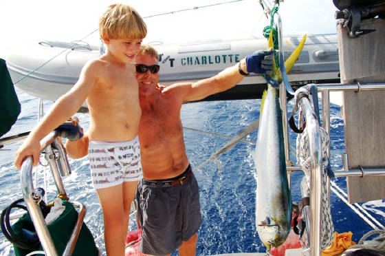
|
| Oil Rig in 4000' of water-Gulf of Mexico | 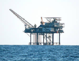
|
Mexico 2009
Mexico 2009 | El Cid Resort waterslide | 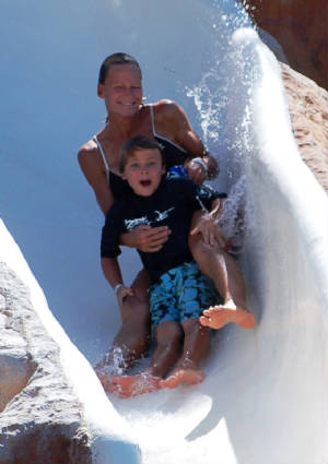
|
| El Cid Resort
cliff jump | 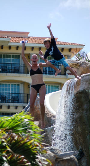
|
22 June 2009; Anchored Isla Mujeres, Mexico- Our last foreign stop of this
trip! We sailed up the coast from El Cid Marina/Resort in Porto Morelos yesterday after five very relaxing
days. Kirsten even remarked, “It feels like I’m on vacation.” Alden
had an awesome time playing with other kids his age and logged hundreds of cliff jumps and water slide descents.
We enjoyed meeting other families from the US who were all down in Mexico relaxing at the ends of their school years.
The resort was a really nice operation with organized beach and pool volleyball, waterpolo, ping pong, and other activities.
And, amazingly, while on one of the marina’s moorings, we were able to access the resort for only ten dollars
a day. It was difficult leaving such shelter and fun activity but with hurricane season fast on our heels,
we departed. It was an easy sail/motor up along the beaches of Cancun and into the anchorage here at Isla
Mujeres. We’ll spend the next two days sightseeing here and purchasing a few provisions for our five
day Gulf of Mexico crossing. The weather window for this crossing is looking pretty good and I suspect
we’ll end up motoring most of the way.
| Alden, James, Carter, Mitch
& Jack cliff jumping | 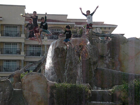
|
| El Cid Resort's
pool | 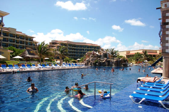
|
18 June 2009; Docked El Cid Marina,
Porto Morelos, Mexico- This is our third day here at El Cid
where we’re thankful for the shore power, protection, and comforts provided by this two year-old marina/resort.
There’s an awesome swimming pool and cliff dive/waterslide at the pool and lots of families here with kids.
Alden has been able to play with some of the kids which he’s been lacking for months. Yesterday we walked into
the small town of Porto Morelos for lunch and groceries then took a shuttle bus back to the resort. Last
night we walked over to the resort and watched a Pre-Spanish (Mayan) dance show. After our months in Central
and South America, this Mayan Riviera area of Mexico is a huge step back towards the “developed” United States.
We’ll spend another day here at the resort before heading north to Isla Mujeres and our five day Gulf of Mexico
crossing.
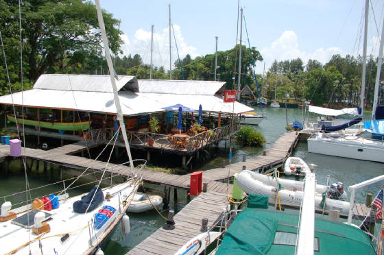
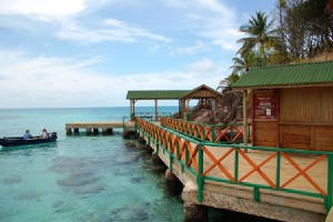
| Marina El Cid, Porto Morelos,
Mexico | 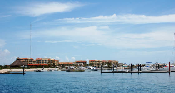
|
Belize 2009
Belize 2009 Our brief
stay in Belize was pretty much a snorkeling adventure. From Guatemala, we headed towards the southern end
of the barrier reef and spent our first night anchored at Hunting Cay. Navigating through the coral
infested waters of Belize requires good sunlight and a sharp lookout. The water is very clear and with
good light, the scattered coral is quite visible. Depths change rapidly from one hundred feet to five feet
in seconds. On the tenth, we motorsailed thirty miles north, inside the barrier reef to North Long Cocoa
Cay and anchored in eight feet of water over sand and grass. There was awesome snorkeling on the reefs
south of the island. Ashore we met the caretakers of this private cay owned by a US nature company who
maintained the island as a nature preserve. As with all the islands we visited in Belize, the sand flies
or “no see ums” were brutal and our skin became a mass of red bites. I’m not if it was
because we were so late in the season or if it’s always so quiet here in Belize, but we were the only boat at each of
the islands we stopped at. The next morning we headed out through Gladden Spit pass to the offshore atoll
of Glover’s Reef. We anchored in the lee of Southwest Cay and then snorkeled on some nearby reefs
before visiting a local dive resort on Manta Cay.
| Typical Belize waters | 
|
| Snorkeling in
Belize | 
|
The following day, while Kirsten and Alden schooled, I joined the resort divers on a morning dive
on the outside wall on Glover Reef’s southeast corner. I’ve never seen so many large grouper
in one area. Thanks to the preserve, these fish are able to reach maturity instead of the dinner plate.
That afternoon, I joined six other divers and two dive masters for a whale shark dive. We were promised
a ninety percent chance of seeing and swimming with these forty foot sharks. A snapper spawn in the area
was attracting these filter feeders who consider the spawn eggs a delicacy. We did two dives that
afternoon, moving inside of the reef for our surface interval between dives. It was a bit of an odd experience
diving in somewhat murky water with the bottom only just visible some one hundred feet below. We waited
for the schools of snapper to “swarm into a ball”, spawn and attract the whale sharks. On the
first dive we saw lots of schooling snapper but no whale sharks. The hightlight of this dive was watching
a dolpin blast towards the surface clutching a snapper in his jaws, right through our dive group. On our
second dive we managed to get a glimpse of two massive whale sharks about thirty feet below us. At best,
it was a fleeting glimpse and not the close up encounters that other divers in our group had experienced two days earlier.
| Halfmoon Cay - Lighthouse Reef | 
|
| Hermit crab | 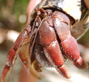
|
On the 13th, we sailed northeast from Glover’s Reef to Lighthouse Reef atoll and anchored just northeast
of Long Cay in perfectly clear water over a sand bottom. That afternoon we swam a few hundred yards astern
to snorkel a shallow reef. We were kept under the constant watch of local barracudas. Conch
crawled all over the sandy bottom. On our swim back to Charlotte Kirsten found a small octopus
living in a conch shell. Early the following morning, jut before daybreak we awoke to painful bites and
the buzzing of mosquitoes. Turning on some lights we discovered that we’d been invaded by these nuisance
insects; amazing that they’d flown upwind in ten knots of breeze from Long Cay. Today was the opening
day of lobster season here in Belize and we witnessed about five local sailing lobster boats motor out to the reef and head
to the fishing grounds. These small wood sailboats are stacked with about eight small canoes.
We counted thirteen fishermen crowding the decks. There must be some local regulations that require
the use of these traditional sailing vessels. When we talked to one of the passing boats, the fishermen
said the live aboard these small vessels for eight days while they fill their barrels and holds with lobster before heading
back to the mainland. Unbelieveable!
| Frigate birds - Halfmoon
Cay | 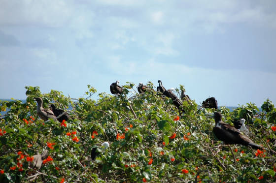
|
| Red Footed Booby | 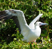
|
| Land crab -
Halfmoon Cay | 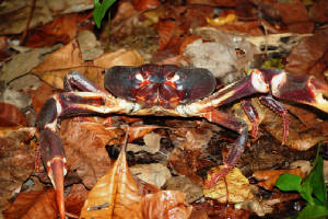
|
Rather than navigate Charlotte through the coral patches of Lighthouse Reef, we motored three miles upwind
to Halfmoon Cay to visit the Firgate and Redfooted Booby colonies. This island is a national park and nicely
maintained walking trails and an observation town allowed us to view these birds close up. A nice litoral
forest covers the island where invasive coconut palms have not taken over. The ground swarmed with huge
hermit crabs and we even saw one rat leave its half gnawed coconut to scurry away. Judging by the many
coconuts with holes gnawed into them, I suspect the island is teaming with rats. Returning to Charlotte
we stopped once again to snorkel around a coral patch in eight feet of clear water. Our only regret with
this Lighthouse Reef stop is not viewing the famous blue hole located about fifteen miles to our north.
| Lobsterboat - Lighthouse
Reef | 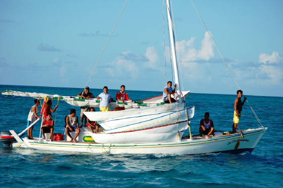
|
Early on the morning of the 15th, we departed Lighthouse Reef and headed north. By dinner
time we were in the lee of Banco Chinchero and managed to enjoy dinner in the smooth waters afforded by this protection.
With no visible decent place to anchor, we proceeded into the night and squally conditions caused by a tropical wave
to our east. It turned out to be a wild night with frequent rain squalls bringing winds to thirty knots
and large seas. Our only consolation was our rapid progress towards the island of Cozumel.
By sunrise we were had reached the southern tip of this Mexican resort island and were soon in its lee where we sailed
north along the west coast in very clear water, following the fifty foot contour line. It was fun seeing
the cruise ships and resorts as we slowly sailed by. We decided not to anchor and proceed another twenty
miles north to Porto Morelos and El Cid Marina. Clearing Cozumel we blast reached with staysail and reefed
mainsail in twenty five knots of wind eventually finding refuge in the El Cid’s protected marina.
Guatemala 2009
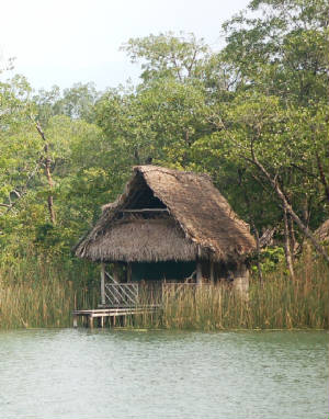
Guatemala 2009 | Outbound Rio Dulce Gorge | 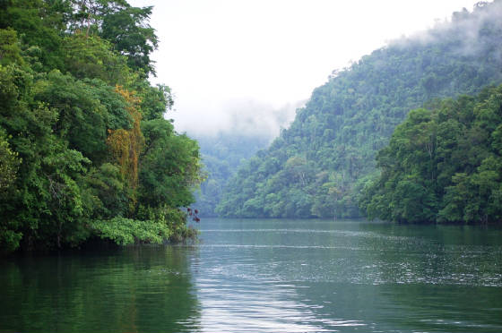
|
| Ak Tenamit Mayan
Center on Rio Dulce | 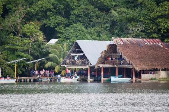
|
| Kids paddling
to school on the Rio Dulce | 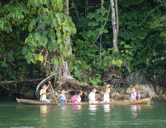
|
| House near Mario's Marina | 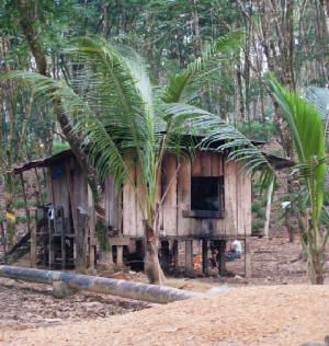
|
| Rubber trees | 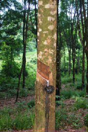
|
We intended to spend a week in Guatemala. We ended up staying for ten days. Most
cruisers spend the six month hurricane season here while some stay for years. We really enjoyed our stay
at Mario’s Marina. Perhaps it was being plugged into shore power and the comforts of air conditioning,
or the clean and convenient pool, or the economical and good dockside restaurant, or the killer happy hours, or the weekly
cruiser’s potluck, or the friendly and appreciative staff or the acceptable wireless internet. Really
it was all of the above. We also liked visiting the bustling river front town of Rio Dulce with its vibrant
fruit and vegetable markets and modern supermarket. I that being so far inland from the ocean while still
living on the boat, was a nice contrast to the months of anchoring off of secluded beaches and islands. People,
cities, and culture, (even third world culture) is a nice change after the relative isolation of offshore islands.
| Rio Dulce school kids | 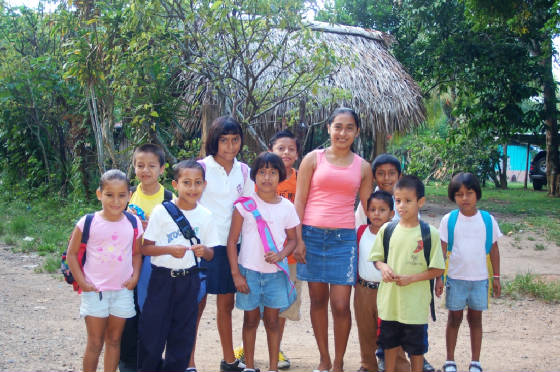
|
| Main street
Rio Dulce | 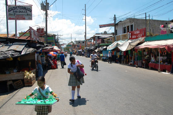
|
| Rio Dulce store | 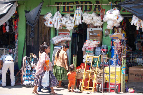
|
| Tikal-Temple One | 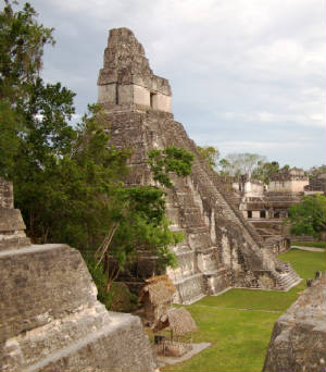
|
| Alden on Temple
Two | 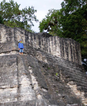
|
Our big outing while in Guatemala was to visit the Mayan Ruins of Tikal. While reasonable package
tours were offered from Rio Dulce we opted to travel like the locals and purchased tickets on the express bus from Rio Dulce
to Flores. This three hour bus ride brought us north to the Peten region and Lago Isabel where the Island
of Flores is connected by a causeway to the mainland. Flores is a tourist hub and dominated by hotels and
restaurants. We opted for the backpacker’s favorite hotel Mirador del Lago hotel with lakefront room
and rock hard pillows. The following day, after breakfast at the awesome Archeological Café, we
took a San Juan Travel van one hour up to Tikal Park and checked into the Hotel Tikal Inn. This is the
nicest of three hotels in the park. One definitely pays a five fold premium relative to staying in Flores.
We were rewarded with the tranquility of staying in the jungle with the ability to visit the Tikal ruins very early
in the morning and late in the afternoon. We ended up staying an extra night at the Tikal Inn.
Being able to take a mid day swim in their pool to cool off was most refreshing.
| Grand Plaza - Tikal | 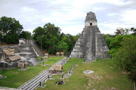
|
| Hotel Tikal
Inn | 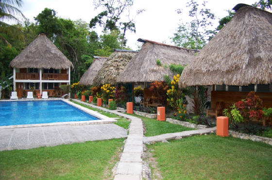
|
| Walking out of Tikal Ruins | 
|
| Steep temple
steps | 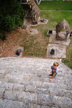
|
We ventured into the ruins at 4:30pm on our first afternoon simply to get a taste of this massive archeological area.
It’s a fifteen minute walk from the parking/hotel area into the grand plaza and most of the ruins.
We contented ourselves with viewing the grand plaza with temples one and two. Wooden stairs allow
one to climb temple two. After two visitors fell to their deaths on the steep stairs of Temple one, it
is no longer open for climbing. It’s hard to believe that the short legged Mayan priests and kings
were able to ascend and descend these very steep stairs. Perhaps they too became part of the sacrifice?
Unlike his dad, Alden is definitely not afraid of heights. Returning to the hotel just before sunset
on the jungle paths through the ruins we were able to view and hear howler monkeys, pezotes (racoon like creatures) and toucans.
After a very quiet night at the inn (no TV or internet access), we woke early and met Boris at 6:30 am for a four hour
private tour. Boris was fabulous and we all learned way more than we will be able to remember about Tikal,
Mayan civilization, and the jungle flora and fauna. As the steamy mid day heat engulfed the ruins, we headed
back towards the hotel, lunch at a comidor, and the Hotel Tikal Inn’s pool. That afternoon at 4:00pm
we did one final hike to Temple the distant temple six. The following morning, Alden and I did a zip line
tour while Kirsten had some quiet time. The zip line is a circuit of wire cables hung from trees.
One dons full body harness and pulley then zips downhill from tree to tree. Alden had a ball and
screamed “yahoo” on each ride. After a final swim at the Hotel Tikal pool, it was back to Flores
on the van and then another night at the eclectic hotel Mirador del Lago. Our bus trip back to Rio Dulce
was definitely deluxe: Alden got to watch the movie “Mama Mia” on the bus video.
| Guatemalan Turkey | 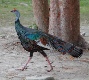
|
| Our Tikal Guide
Borris | 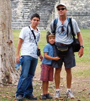
|
| Temple Five - Tikal | 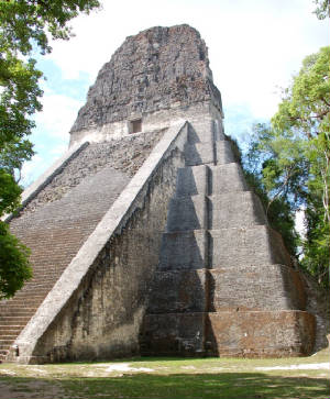
|
| Pizote | 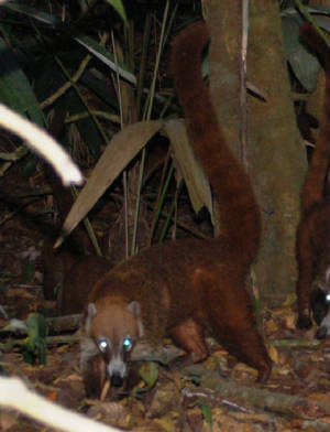
|
After four days away, it was great to be back at “Charlotte” and Mario’s Marina. We
finished our days in Rio Dulce with some shopping for provisions, and spending time with the many cruisers assembled in this
freshwater hurricane shelter. We were surprised to find only one other kid boat here. It
seems that all the kid boats have gone north or south with the fast approaching hurricane season. At 0500
on June 9th with the first glimmer of morning light, we slipped our dock lines and motored out of the Rio Dulce.
With a 0840 high tide at the river bar we needed to get an early start. It was an enjoyable trip
through Lake Golfete where we dodged fishermen’s gill nets and then into the Rio Dulce gorge where Mayan school children
and adults paddled their Cayucos to school and work. As planned, we dropped anchor at Livingston at 0745
and I made a quick trip to our customs agent to check out of Guatemala and receive our “zarpe.” At
0830 we crossed our fingers and headed back over the shallow Rio Dulce bar, using our inbound GPS track as a reference.
The tide was exactly the same 1.7 foot high we experienced inbound and we surged out at full speed blasting through
the same small mud mound we hit coming in. By 0900 we were in deep saltwater again!
| Mario's Marina-Rio Dulce, Guatemala
|
29 May 2009; Docked Mario’s Marina, Rio Dulce, Guatamala:
We’re
now twenty miles inland from the Caribbean, sitting in fresh water, plugged into 220V/50amp shorepower, with the air conditioning
on and good wireless internet access. We had heard and read about Guatamala’s Rio Dulce for many
years and had wanted to visit if only for a week. Most cruising sailboats come for hurricane season and
either leave their boats and return home or travel around Central and South America or just hang out here in the Rio enjoying
the large, social cruising community and affordable restaurants and marinas. Mario’s is an awesome
place with a very friendly, easy going staff. When I stopped by the office this morning to registar, Marco,
the manager said “no paperwork, just pay before you leave.” What a contrast to the four page
contract and hassles of Shelter Bay Marina in Colon. And, it’s only $15 per day here.
After swimming in the small but clean fresh water pool to cool off, we enjoyed a fantastic dinner at the bar/restaurant,
only fifty feet from Charlotte and met some of the other cruisers who are all here for the entire hurricane season.
There’s a small store, library, DVD rental, shaded hammocks, and killer happy hour. It’ll
be difficult to leave next week. The town of Rio Dulce/Frontera is a two mile dinghy trip upriver.
Before venturing further into Guatemala, I should talk more about our voyage here.
In the wee hours of 25th we ended up slowing down by rolling in the genoa to make Guanaja landfall
with good light. At 0700 we motored through the narrow but deep North East Cay Channel and then reached
southwest inside the reef in perfectly flat, clear water to the island of Bonacca where two thirds of the 10,000 strong Guanaja
population lives. After clearing in with Honduran customs and immigration then visiting the fruit market
and dockside gas station, we returned to Charlotte and motored in company with the Dutch cutter Marelot back up to
Graham’s Cay. By noon we were anchored in twelve feet of perfectly clear water over a sand bottom
just off of Graham’s Cay resort. We spent the afternoon swimming and then had the delightful Dutch
couple off of Marelot, Yoost and Yoke, over for dinner. The following morning we schooled,
did boat maintenance, and then swam from Charlotte. I spent about an hour at the masthead jury
rigging our anemometer strut. After twenty years of service, the aluminum retaining collar had failed.
With tape and some line stays, I was able to secure it in place. We only need it for
another month as we’ll step the mast and then strip it for painting in Seattle. While aloft, I took
these photos of Kirsten swimming with a dolphin who took up residence for the next day between Marelot and Charlotte.
That afternoon we took our inflatable dinghy up to Northeast Cay Channel and snorkeled both inside the reef and
in the pass. The pass has fantastic coral and a steep drop-off with amazing fan coral and huge schools
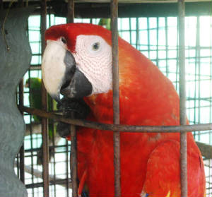
of blue tang. That night we had dinner ashore with Yo and Yo. Graham’s Cay is
a very cool place, immaculately kept, quiet and relaxing with beachside bar, pens of turtles, lobster, grouper and conch,
and a cage with a Macaw and two parrots.
Early on the 27th, we departed Guanaja, stopping at Bonacca long enough to clear out with customs
which took over two hours while I waited for the immigration officer to go to the bank. Bank visits can
take hours as there was a long line and the service was muy despacio. At 1100 we set sail in twenty
knots of easterly wind, rounding Guanaja’s southern tip and heading west with poled out genoa and main, roaring along
at nine knots. As afternoon turned into night, we sailed past Roatan and then Utila with diminishing winds.
By 1900 the engine was on and we motorsailed west with the night. At about 2000 we were again visited
by the USCG who hit us with searchlight and hailed us on the VHF. When we responded with our boat’s
name, they said “Oh, you again,” and quickly sped away. At 0230 local time, I was snoozing
below as Kirsten kept watch when I felt a boat-shaking rumble and rushed on deck. Kirsten had just slowed
the engine as we both thought something was wrong and causing huge vibrations. Slowing down and shifting
to neutral did nothing to alleviate the shaking which soon subsided. Another minute later and the
shaking returned. I guessed that it was an earthquake and Kirsten verified that indeed an earthquake had
hit the area by hearing VHF conversations with local port officials. On the morning cruiser’s SSB
net, we learned that a 6.8 magnitude quake, centered just eighty miles from us, had hit. We’ve heard
of no damage from the quake.
| Rio Dulce gorge
|
At 1000 yesterday morning we crossed over the shallow,
muddy Rio Dulce river bar to the town of Livingston, Guatamala. With the exception of a sea buoy, there
are no makers for this river. A 1.9’ high tide was predicted for 1100 and we wanted to transit an
hour before high water so that if we got stuck, we might get off as the tide came in. As we reached the
sea buoy, an experienced bar crossing cruiser called on the VHF and recommended proceeding at full throttle to plow through
the mud humps rather than creeping in and gutting stuck. We took his advice and advanced at seven knots,
heading for the river gorge as recommended in our cruising guide. A local “launcha” stood by,
prepared to offer towing service if we got stuck. Charlotte’s draft is six feet. Our
depth sounder went from 8, 7, 6.8, 6.5, 6.2 and we felt a little hesitation as we blasted through one mud mound and then 6.5,
6.3, 6.5 all the way to deeper water off of Livingston where we anchored in ten feet of water. After an
hour, a “launcha” with customs, immigration, health officer, agent, and port captain paid us a quick visit and
were amazingly fast, courteous and professional. We then went ashore where we paid a local dock boy two
dollars to watch our dinghy (a highly recommended practice) and exchanged dollars for quetzals and had lunch.
Livingston is a cool town. With no roads accessing the town, launches come and go from other coastal
towns and the river. It’s definitely on the backpacker circuit with lots of café/restaurants,
craft vendors, and hostels. We met one backpacker from the U.K. and offered to give him a ride back up
to Rio Dulce. Jack, an 18 year old from Brighton; England, has been backpacking throughout South and Central
America for the past few months before starting school this fall.
| Rio Dulce gorge
|
From Livingston, we motored through the ten mile long
Rio Dulce gorge which cuts through three hundred foot high, jungle clad cliffs. The river runs quite deep
in this area. Insects and birds provide a deafening chorus of jungle noise. Emerging
from the gorge we transited Lake Golfete and motored downwind at seven knots in seven knots of wind. With
no airflow, intense sun, and high humidity, we all sat dripping with sweat. Alden and Jack dragged their
feet in the water while sitting on the stern. By 1600 we backed into our slip here at Mario’s and
quickly dug through the stern lock for the shorepower cord to get our air conditioning working. Once Charlotte
was secure and in dockside mode, I brought Jack upriver two miles to the town of Rio Dulce where he caught a bus to Tikal,
his next stop. Alden and Kirsten headed for the shaded pool where Alden spent time perfecting his back
flip and many other creative dives. Right now we’re feeling that this Guatemala river diversion will
be well worth the time and extra miles it took to get here.
Guanaja, Bay Islands of Honduras 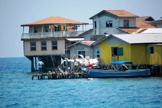
| Bonnaca-Guanaja
|
| Macaw at Graham's Cay
|
| Dolpin swimming off "Charlotte"-Graham's Cay
|
24 May 2009; GPS 16.1N 084.6W or 12nm north of the Honduran
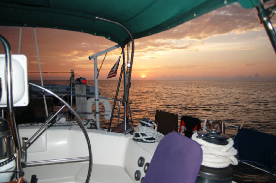
coast; 70nm east of Guanaja, Bay Islands, Honduras. Its 2030 local time and we’re sailing along on a star filled,
moonless night with fifteen knot winds on our starboard quarter. The genoa is poled out to stb and the
main prevented to port. Seas are slight and its comfortable sailing. We departed Cayos
Vivorillos this morning at 0700 and motored in very light winds until 1700 when the easterly trade winds filled in.
If winds hold steady, we’ll arrive in Guanaja tomorrow morning at 0800; a good time with enough sun at our backs
to pilot through the reefs to Bonnaca where we’ll clear in. After enjoying a nice pasta dinner in
the cockpit, we were settling in for the evening and adjusting our eyes to the black night. On deck, I
heard the roar of an approaching speedboat but could see no lights. Our biggest fear was being intercepted
by drug runners or pirates. We hadn’t heard of such activity in this area on the cruising nets.
I grabbed our handheld searchlight and illuminated the vessel now only a hundred feet astern. It
immediately switched on its running lights, searchlight and announced “US Coast Guard.” What a relief!!
We switched on our deck lights and they took up position about twenty feet away from our stb quarter. They
spent about fifteen minutes alongside checking over our boat information, communicating with their command center to verify
our registration and personnel information. They questioned us about where we had come from and were headed,
and if we’d seen anything unusual. I asked where they had come from but was informed that they couldn’t
tell us. Satisfied that we weren’t running drugs, arms, or illegal immigrants, they zoomed off into
the night, switching off all their lights.
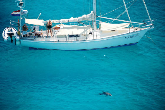
| Dolphin swimming off of "Marelot"
|
| Kirsten swimming at Guanaja
|
| Graham's Cay-Guanaja
|
| Guanaja
|
Earlier in the day Alden schooled, a testament to the
calm conditions, and Kirsten cleaned louvered cabinet doors. With the warm, moist conditions we need to
wipe down every surface of the boat now and then to control mildew. After lunch, while crossing a coral
shoal rising to within 30’ of the surface, we hooked two barracudas on our fishing lines. While some
cruisers eat these predators, we still have far more tasty fish in our freezer. I managed to haul them
in, hold them down with a towel, and use needle nose pliers to remove the hooks from their murderous jaws before returning
them to the sea. While eating dinner in the cockpit I spied a green dugout canoe drifting on our starboard
side. With binoculars we were able to see it occupied only by seagulls. It must have
drifted away from a poor coastal fisherman.
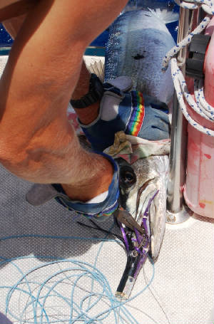
| Removing lure from baracuda's viscious mouth
|
Last night we anchored off of Cayo Vivorillos after an uneventful thirty hour passage from Providencia.
The Vivorillos are one of the many coral surrounded reefs on the Nicaraguan Bank. They lie about
forty miles north of the Nicaragua/Honduras border. Anchoring between the two, small, southern islands
in twelve feed of water, we felt quite isolated. There were no other boats within VHF range or fishermen
ashore. In the past, fishermen have set up camp on these islands. After visiting one
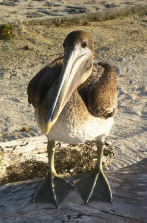
of them by dinghy, it appears that it’s been a long time since they were inhabited by anyone but the thousands of frigate
birds, terns, gulls, and pelicans who had nested ashore with eggs and young offspring. Listening to the
Northwest Caribbean Cruiser’s Net each morning we’re impressed by how many cruisers take time to explore these
offshore reef systems; anchoring for days to spearfish, dive, and enjoy the solitude. This week’s
calm conditions are an ideal time for such activity. After lunch we anchored the dinghy in five feet of
water over sand to do some snorkeling. After being visited by four curious barracuda at our first spot,
we decided to shift to another location where we might swim without such scrutiny. Alden spent a solid
half hour hunting out starfish to inspect on the sand bottom. He never tires of diving down, picking them
up, turning them over and watching them retract into their hard shells. The water was a very comfortable
temperature and nice relief from the hot, humid air made less bearable by the calm conditions. After a
good night’s sleep, both Alden and I woke just before sunrise itching and scratching from no-see-um bites.
Although we were a good quarter mile from shore, they still managed to find us. Some repellent and
the rising sun soon provided relief.
| Vivorillo Cays sunset
|
Isla
Providencia 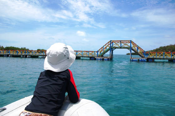
| Lover's Lane bridge-Isla Providencia
|
23 May 2009; GPS Position 15.3 N 082.5 W; 60nm from Cayo Vivorillos;
It’s
now 0230 and we’re motorsailing in five knots of NNE wind and calm seas across the reef strewn Nicaraguan Bank via the
Main Cape Channel. We departed Providencia this morning at 0600 and spent the day sailing and motorsailing
NNW. It was a pleasant day underway with an easy motion and the cockpit shaded by bimini and side curtains.
We read a biography of Madame Curie to Alden and played Sequence. Although the fishing
lines were out, there were no strikes. A low pressure system over Cuba has squashed the normal easterly
trade winds in this area. With a more leisurely schedule, we would have waited in Providencia for the normal
winds to return but with over three hundred gallons of diesel in our tanks and many places yet to visit in our remaining month,
it’s motor on. There’s no moon tonight so the sky is dark except for a sprinkling of
stars between the clouds. At around 2330, when Kirsten was on watched, we met a sailboat on a reciprocal
course, passing within a hundred yards of each other. That’s the only other vessel we’ve seen
since Providencia. At our current speed of 6.5 knots, we should arrive at Vivorillos around noon.
These reefs/small islands lie about thirty miles north of the Nicaraguan/Honduran border and Cabo Gracios a Dios.
| Providencia-main road around the island | 
|
| Crab Cay Park-Isla Providencia
|
We enjoyed our brief stay on Isla Providencia.
On the 20th, we dinghied to Crab Cay, a marine reserve Island to snorkel. The water was
just a bit cooler than in the San Blas Islands. Plenty of fish and coral are scattered around the island.
After a group of Columbian tourists departed, we had the island and surrounding waters to ourselves. According
to local tourist info, the reef system of San Andreas/Providencia is the world’s third largest; after Australia’s
Great Barrier and the Bahamas Abacos. Returning to the harbor, we snorkeled the coral off of Morgan’s
Head. Rick off of Sea Wolf joined us for these underwater adventures. When
we arrived in Providencia, Sea Wolf was the only cruising boat there. Rick’s wife had flown
back to the U.S. for a few days. Sea Wolf departed San Francisco ten years ago and has cruised
from there, down the Pacific coast of North America, transited the Panama Canal, and cruised the southwest Caribbean.
On the 21st, Rick and I did a scuba dive just off of Morgan’s Head in 30’ of water.
We saw some barracuda, interesting coral, and lots of yellow tail snapper. Our dive ended abruptly
when a low pressure air hose burst on Rick’s regulator. That afternoon Kirsten, Alden and I hired
a local “Taxi” to drive around the island. Sitting on wooden bench seats in the back of Elkton’s
pickup, we set off on a two hour tour. Houses are quite modest and typically Caribbean style.
The locals seem to live a stress free, comfortable life with adequate infrastructure for heath, water, electricity,
and food. Most everyone gets around on scooters and small motorcycles. We stopped at
Southwest Beach for a quick swim, being careful to park Elkton’s truck on a hill; the starter being shot.
Back in town, we met up with Mr. Bush, our ship’s agent (one need’s to use an agent and Mr. Bush is the
only one), to receive clearance papers. Then it was back to Charlotte for dinner and prepare for
next morning’s early departure.
| Elkton-our Providencia tour guide
|
20 May 2009; Anchored Santa Isabel, Isla Providencia; We arrived
at this remote island early yesterday morning after a delightful day of sailing in mild conditions. With falling seas and
eight to ten knots of NNE winds, we spent the evening close hauled averaging about five knots. By 0200
on the 19th, we arrived off the SW corner of Providencia, motored on the the banks and anchored off the entrance
channel to await daylight. Yesterday we motored through the reefs, through the well marked and wide channel
then anchored off of Santa Catalina island. Late in the morning port officials and the agent, Mr. Bush,
paid us a visit. These officials couldn’t have been more friendly or professional. After
doing wash, school, and maintenance we visited the town of Santa Isabel. Friendly people, ample stores
and restaurants, clear waters, a nice anchorage; we can see why others have found this island to be delightful.
We agree that it is probably what the Eastern Caribbean islands were like fifty years ago before they were overrun.
After visiting the bank and Mr. Bush, we hiked over Lover’s Lane, a floating foot bridge connecting Santa Catalina
to Providencia. We followed a pirate-themed trail out to Morgan’s Head where the infamous pirate
hid treasures. As sun set, we returned through the small town of Santa Isabel, our tender, and Charlotte.
Today we’ll explore this Columbian Island of 5000 residents.
| Southwest Beach-Isla Providencia
|
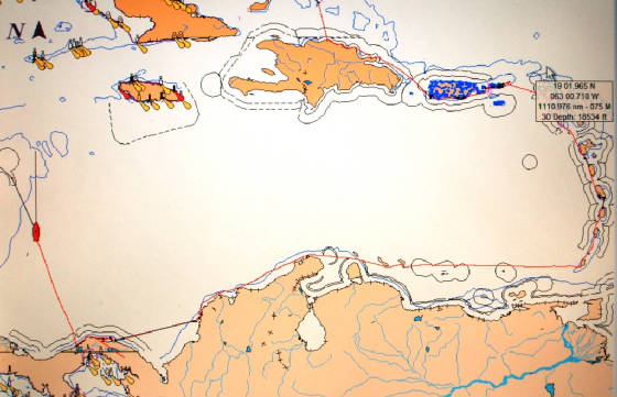
| Our track through the Caribbean
|
|